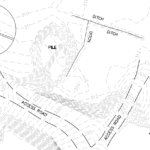
Drone surveying and mapping solutions allow services to be completed for a larger area in less time and in more detail than tradition methods. Services start with a detailed orthomosaic which is georeferenced to known points. Data can then be post-processed to create a number of different high value mapping, survey and topographic products. Maps created by drone also present up to date high resolution aerial images that can be used along side topographic information.
Industrial inspections performed by an unmanned aerial system produce high resolution photos, video and even 3D models. Drones can be used in situations that would otherwise require a human to be put into a high risk situation. Inspections of towers, roofs, solar systems, wind mills and other hard to reach situations can be done without costly and time consuming climbing crews.
- Tower inspections
- Roof inspections
- Line inspections
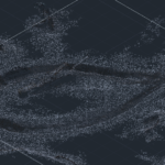
3D Models and Point Clouds can be created using data captured by the unmanned aerial system. 3D models can be used for architectural presentation as well as existing conditions, topographical mapping, and job site progress evaluations. 3D models create a great visual aid to go along with mapping and engineering plans. Point cloud and drawing shape file creation allows for data use along a wide variety of processing and software platforms.
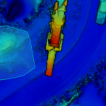
Mining and Stockpile calculations can be performed quickly and more frequently with the use of a drone, without ever having to put a field crew on a pile or near quarry wall. Data collected with the drone can be used to determine stockpile volumes, areas, and cut and fill volumes.
- Aggregate stockpile volume
- wood chip pile volume
- mulch pile volume
- log pile volume
FAA Compliance: All of our operators are FAA certified for sUAS commercial operations. Our services include coordinating with air traffic authorities and flight charts to ensure that the operation will be in compliance.


